
Planned since the 1950s, the Marginal de la Selva is a $1 billion highway project that would create a paved land passage through the Andean foothills in Colombia’s Amazon region. The highway, when complete, would allow land cargo to cross South America from the Atlantic to the Pacific without having to enter the Andes Mountains, opening an enticing trade route from Venezuela to Ecuador through Colombia.
While the majority of the road project has been completed, there is still one particularly sensitive stretch that has yet to be finished: a section that passes between two of the country’s national parks. As expectations for the road project rise, rates of deforestation have soared and the zone is now one of eight “deforestation hotspots” in Colombia, giving rise to concerns about the project’s possible impacts on the parks.
Treasure trove of biodiversity
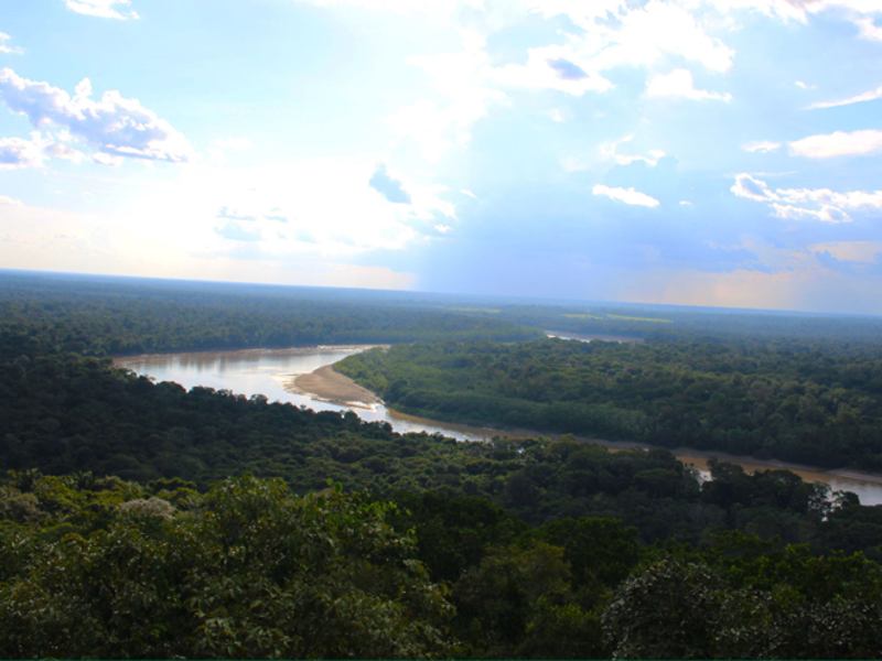
Colombia is the world’s second-most biodiverse country after Brazil. In particular, the foothills of the Colombian Andes and the nearby transition zone between the Amazon and the eastern plains regions known as the Amazonian piedmont – where the Marginal de la Selva is being routed – contains exceptionally high levels of biodiversity even for Colombia, according to the country’s national parks authority.
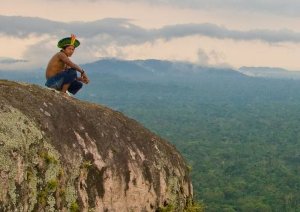
To the south of the projected highway, Chiribiquete Natural National Park, which is nearly the size of Belgium, is the largest protected area in the Amazon. Known for its unusual elevated rock formations and ancient indigenous art dated to 18,000 BC, the park is also rich in biodiversity, housing 41 species of reptiles, 49 amphibians, 145 birds and at least 13 threatened mammals, as well as four indigenous groups that are believed to remain in isolation.
Even closer to the planned highway, across the Guayabero River, sits Serrania de la Macarena National Park, which protects an independent mountain range that connects three of Colombia’s five regions: the Amazon, the Andes and the eastern plains.
La Macarena National Park is also home to the Caño Cristales River, one of the most famed water bodies on the planet. Known as the “river of five colors,” the Caño Cristales is home to a unique species of plant called Macarenia clavigera that for a few weeks per year explodes into a living rainbow of gold, olive green, blue, black and red that contrasts vividly below the water’s crystal surface.
Despite the region’s level of biodiversity, it has never been comprehensively surveyed. Andrew Crawford, associate professor in the Department of Biological Sciences at University of the Andes, told Mongabay that researchers are only now starting to conduct studies and collect specimens.
“Researchers are just now finally arriving to study the migratory and endemic species found near the Macarena National Park,” said Crawford, who explained that years of civil conflict and guerrilla activity had kept scientists at bay.
However, Crawford said that the improvements in security conditions that are attracting scientists are also bringing the road development: “it’s a race between biologists and development to see who’s going to get there first.”
In September 2016, Edersson Cabrera, the director Colombia’s meteorological institute IDEAM, told local newspaper El Tiempo that he had satellite imagery demonstrating that the forest corridor connecting la Macarena to the Amazon and Chiribiquete is disappearing at an alarming rate, with only 2.6 kilometers of direct connection remaining.
“Fauna and flora populations pass through these forests. Right now, there is only one direct connection because the rest of the Amazonian piedmont was lost years ago,” Cabrera told el Tiempo.
And he cautioned that even that last connection fragment may be disappearing.
“The only connection remaining is the area of the Marginal de la Selva, in San Jose del Guaviare municipality, but it has been disappearing,” Cabrera said. “Only a 2.6km area of forest is left directly connecting the Amazon and the Andes, but it’s possible that space has been reduced over the course of the year.”
One of the species threatened by the road development is the jaguar, which needs large tracts of land and strong connections between populations. Cabrera told Mongabay Latin America that the deforestation in the Marginal de la Selva region “is a threat for the movement of species such as the jaguar, due to the fragmentation of the lower Colombian Andes and their connection with the Amazon.”
Part of a larger pro-development vision
The Marginal de la Selva highway is part of President Juan Manuel Santos’ Master Intermodal Transport Plan. A major feature of Colombia’s post-conflict plan to integrate remote regions of the country into the national economy, the plan has a cost of approximately $3.5 billion per year, or 1.3 percent of the country’s GDP in 2015.
With the country set on improving its agricultural economy, one of the main goals of the national transportation plan is to allow semi-trucks to travel 37 miles per hour in the mountains and 50 miles per hour on flat land like the Marginal de la Selva, according to national road agency INVIAS.
INVIAS told Mongabay that the final phase of Marginal de la Selva project is still in the “studies and design” stage.
This final stretch of the road will cost around $100 million, of which $66 million is earmarked for bridges and 72 kilometers of pavement.
In a press statement, the agency said the road “will benefit first and foremost rural producers including projects such as industrial agriculture, petroleum, trade and social development.”
More deforestation near national parks expected
Environmentalist and sustainability expert Rodrigo Botero has been working for the past five years with his non-profit organization FCDS in the region between the town of Macarena and San Jose del Guavaire where the Marginal de la Selva highway is planned.
Botero explained that while informal roads built by farmers have existed in the area for decades, the local Guaviare department has recently been undertaking “small bridge and drainage projects” in the area as part of its regional development plan. The projects have caused “deforestation to shoot up exponentially,” Botero said.
Alerted to the deforestation in this migratory corridor by IDEAM’s satellite imagery, environmental government agency Corporation for Sustainable Development of the North-East Amazon (CDA) has ordered local construction on the road to be ceased until an environmental license is issued for the Marginal de la Selva highway project.
CDA Director César Meléndez claimed that illegal armed groups are behind the increased deforestation in region.
“There are armed actors who are putting pressure on the local rural farmers to destroy the forest,” Meléndez said. “We don’t know what their economic motives are exactly, but they have burned and cleared two thousand hectares already.”
Melendez said that the deforestation in expanding into Serrania de la Macarena National Park and there are new illegal roads being built toward Chiribiquete where armed groups – including a FARC dissident group that is still active – are increasing coca cultivation pressure in the region.
Lacking institutional presence
Before closing down the road construction in March, CDA officials said they tried to set up a dialogue with residents of the local hamlet of Cachicamo to discuss the deforestation in the area. According to Wilfredo Pachón, local CDA Director in San Jose de Guaviare, the community reaction “was pretty bad.”
“They wouldn’t let us talk at all during the meeting, and since then we haven’t been able to return,” Pachón said. “We identified actors from the armed group who were organizing the response at the meeting.”
CDA Director Melendez said that the agency is working with INVIAS and the National Environmental Licensing Authority to develop a highway that would still allow biological connectivity between la Macarena and Chiribiquete.
However, Colombia’s armed forces and police across the country have been ineffective in moving into territory formerly controlled by FARC rebels, and the Marginal de la Selva area is still not under the control of state authorities. As such, illegal armed groups are still exercising significant control, making it impossible for state institutions to coordinate and ensure environmental laws are followed.
Botero and FCDS are working with rural farmers in the communities around Marginal de la Selva to build environmental consciousness through conservation studies, reforestation programs, seed collection and eco-tourism pilot projects. However, he is still concerned that the minimum institutional standards necessary to ensure sustainable development of the highway are not yet being met.
“As the situation stands today, the state institutions in the area are totally unprepared for the impacts that this project could bring,” Botero said. “In the case that the state cannot provide territorial control, it is better that it stays as a undeveloped network for rural farmers.”