
Manaus and Santarém, Brazil – From the southwest to the southern edge of Pará, in the Tapajós River basin, smoke from forest fires caused by arson covers municipalities and highways. In the cities of Trairão, Aveiro, and Belterra, in the southwest of Pará, and Jacareacanga, in the state’s southern edge, the sky is opaque and the air is suffocating: the toxic smoke from the fires combines with the morning mist. Even in this tropical rainforest, the treetops are succumbing to the yearly increase in fires and environmental degradation.
On September 17, Amazônia Real, in partnership with Amazon Watch, witnessed this attack on the rainforest, Indigenous peoples, smallholder farmers, and biodiversity from up above during a flyover. It was the second flyover by the agency this year. The first was on the border between the states of Rondônia and Amazonas. The new flyover route included the surrounding municipalities, highways, and areas of the following National Forests (Florestas Nacionais – Flona): Jamanxim, Tapajós and Crepori; the Tapajós National Park; the Tapajós Environmental Protection Area; and the Munduruku, Bragança-Murituba, Munduruku-Taquara, and Sawré Muybu Indigenous lands.
From the sky, smoke from the fires obscures the environmental destruction on the ground – a combination of extensive deforested areas, pasture farms, and vast illegal mining sites. These activities cause a ripple-effect of ecological damage, from the pollution of rivers, worsening health conditions, to an increase in social conflicts.
Hot spots in Pará’s Conservation Units (UCs) on BR-230 and BR-163
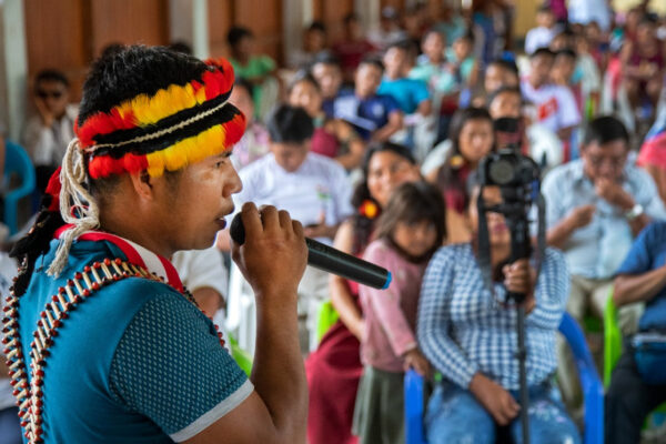
Indigenous leader, Alessandra Korap Munduruku, says that the increase in deforestation in the Tapajós region is the result of market expansion for natural resource extraction and agribusiness, which emerged with full force in 2019 with the construction of the Ferrogrão railroad for the transportation of soybeans and corn, as well as the arrival of the multinational mining company, Anglo-American.
These major projects promise prosperity and attract a large number of workers, prospectors, and loggers, increasing the encroachment and invasion of Indigenous lands.
“Everything you saw from above [overflight] is what we already see down here. We know about the projects planned for this region, spanning from Mato Grosso to Tapajós. Everything that was illegal is now legal,” reports Alessandra Munduruku to Amazônia Real.
Alessandra mentions the Ferrogrão railroad – also used for grain transportation, hydroelectric dams, and mining – as the main vector for the devastation. “Mining in Indigenous lands of the Middle Tapajós is very serious, mainly because some [territories] have not been ratified, such as Sawré Muybu. They’ve already brought in rafts and big machinery. Another thing is the removal of wood. In Sawré, there is already a sawmill, there’s an increased presence of loggers,” the leader points out.
Pará is the Brazilian state with the highest rate of fires in 2020, if only the Amazon biome is taken into account. Between January 1 and October 6, there were 26,696 fires, according to monitoring by the National Institute for Space Research (Instituto Nacional de Pesquisa Espacial – INPE). In the same period of 2019, 17,931 outbreaks were registered, an increase of 49 percent. Unlike 2015 and 2016, the dry spells in 2019 and 2020 are not related to El Niño, the phenomenon of warming in the Pacific Ocean that causes a drastic reduction in rainfall in the northern region of Brazil, interfering with seasonal weather patterns.
Deforestation also reached its highest rates in Pará. As of last August, the state ranks first in this grim indicator. That month, the state was responsible for 37% of deforestation in the region, followed by Amazonas and Acre, according to the Institute of People and the Environment of the Amazon (Instituto do Homem e Meio Ambiente da Amazônia – Imazon), an independent organization based in Belém. In total, the Amazon saw a 68% increase in deforestation alerts in August compared to the same period in 2019.
The Overflight
Amazônia Real’s team took off at dawn on September 17. In the region overflown, air traffic is intrinsically linked to mining, and even a simple trip needs to be done discreetly. The team, when trying to see the forest, soon noticed the humid mist mixed with the smoke.
Arthur Massuda, the geoprocessing analyst who accompanied the overflight to identify the fire outbreak spots, explains that the Middle and High Tapajós comprise a mosaic of Conservation Units (UCs) and Indigenous lands occupied by mining complexes spanning kilometers, rivers muddy with tailings, and with rafts and dredgers in operation, as well as areas deforested with fire with complete disregard for the UC’s borders.
“As we flew over the Munduruku Indigenous land, at a certain point the pilot had to change route due to the low visibility caused by the ubiquitous smoke. Since it was a mining area, the flow of clandestine airplanes is intense and the chances of collision are real. From the ground to the skies, it is a dominated region,” the analyst reports.
According to Massuda, most of the fires were located in rectangular areas, indicating intentional land clearing. He says that, although fires were greater near the highways that border UCs and Indigenous lands, these areas were not free from smoke and fires.
Pressure on Indigenous Territories and Conservation Units
At the request of Amazônia Real and Amazon Watch, researcher Camila Ramos from the National Institute of Amazonian Research (Instituto Nacional de Pesquisas da Amazônia – INPA), analyzed hot spots in the region overflown by the team to serve as supporting material, based on data from the report “Brazilian Amazon Fires Intensify in September.” This analysis uses data from the MAAP (Monitoring of the Andean Amazon Project), a project for monitoring deforestation and fires in real time conducted by the NGO Amazon Conservation Association. Camila is a doctoral student in the Tropical Forest Science Program at INPA. She studies the dynamics of deforestation and fire in the Central Amazon region.
Camila Ramos warns of the increase in large fires in the surrounding areas and even within the Indigenous Territories (TIs) in the Tapajós River basin, particularly those of Sawré Muybu and Munduruku, both inhabited by the Munduruku.
She claims that two Indigenous lands and the southern portion of the city of Jacareacanga saw anywhere from twofold to as much as a sixfold increase in hot spots between July 1 and September 17 (the so-called “burning season”), in comparison with the same period in 2019.
According to Camila, the situation of the Sawré Muybu TI, in the Middle Tapajós, is one of the most worrisome. Within the territory, the number of fires increased from 10 to 23 in the analyzed period, a 130% increase. But when the analysis is expanded to a 15-kilometer radius around the Indigenous Territory, MAAP detects 443 hot spots, compared to 67 last year.
“It is clear, in the case of the Sawré Muybu IT, the pressure is at the edges of its territory, with an increase of 560% in hot spots,” points out Camila. The Munduruku from Sawré are in a vulnerable situation, as their TI has not yet been ratified.
Only the southern portion of the municipality of Jacareacanga, neighboring the Munduruku and Kayabi ITs, is comparable to the expansion of hot spots around the Sawré Muybu Land. This year, from July 1 to September 17, there was an increase of 497% in relation to the same period in 2019, from 203 to 1,213 spots.
“This increase is a red flag, indicating a worrisome increase in the use of fire for this southern region of Pará close to northern Mato Grosso,” explains Camila. According to the researcher, this might be an attempt to mark TIs for future land-grabbing.
She also points to the accelerated expansion of mining activities within and around the TIs. According to Camila, it is currently taking place on the Munduruku TI, from south to north, as detected by the MAAP.
“On the map observed, five mining areas can be identified, located around the Marupá River. This progress has been happening year by year. Zone 1, the oldest, is active and expanding, while Zone 2 began in 2017, west of Rio das Tropas. Over the next two years, the prospectors advanced to Zone 3, in another part of the same river and which is still actively expanding,” she says.
This year, from May to September – in the middle of the coronavirus pandemic – satellite images detected “an increase in whitish spots in the middle of the green forest, as if they were open veins of forest destruction,” the MAAP report informs.
These spots indicate that the mining is advancing over Zone 4, located between Rio das Tropas and Cabitura River (or Cabitutu), and close to some villages. Zone 5, west of Rio das Tropas and north of the Munduruku TI, had already started its activities in 2018, but accelerated in 2019 and this year.
“Illegal mining has grown rapidly within the Munduruku TI in recent years, advancing on new areas to be explored. This has an impact on rivers, streams, and increases deforestation within the territory,” warns Camila.
She also points out that, although it is an illegal activity, mining not only puts pressure on Indigenous communities, but also expands its tentacles into politics. With a government that is sympathetic to its cause, the scenario becomes frightening. Earlier this year, President Jair Bolsonaro submitted a bill (Projeto de Lei – PL 191) to Congress, which enables economic exploitation of water resources, livestock, and mining within the TIs.
“This signaling and expectation that the government will approve mining in the TIs increases the number of invaders and degraded areas. These invaders deceive and coerce Munduruku Indigenous people to cooperate and participate in mining activities, leading to the swift destruction of the forest,” adds researcher Camila Ramos.
According to Alessandra Munduruku, Jair Bolsonaro’s administration does not acknowledge the existence of Indigenous peoples when it authorizes the exploitation of the natural resources on Indigenous lands, and does so without consulting them.
“They want to sell the Amazon with us all inside. I say ‘us’ referring to the Indigenous, the riverine population… There are the animals, the ecosystem that depends on one another: river, forest, roots, fish. Trees depend on us. Everything is linked among themselves. The government denies our existence. Only people from other states, from other regions and countries are entitled to exploit and expel. And why are we not entitled, since we have lived here for so many years?” she asks.
According to researcher Paulo Barreto from Imazon, the three components that have pushed for deforestation in the region are the gold and livestock markets, conditions that enable other sectors, such as timber extraction.
“This market strength is very impressive. Many people say that it’s not the farmers who are doing this, but the grileiros (land-grabbers). But it’s all connected. There’s some guy on one end acting as a land-grabber, practically stealing public land because the price of the land is high and he will make money because later he will get some cattle on it or will sell it to someone. And the price is high because the slaughterhouses are buying cattle at a steep price, the land-grabber is the tip of agribusiness, he is part of this chain,” claims Barreto.
Mining and Lack of Environmental Monitoring
According to Paulo Barreto, the increase in cattle prices, exports to China, paving of the highway and the reduction of environmental inspection are among the main agents of the new frontier expansion in this region of Pará. Mining is encouraged by the increase in the value of gold.
Barreto explains that the price of cattle rose 58% since 2018, and exports to China, one of the main consumers of the product, was one of the reasons for this surge. Mining has been encouraged by a 40% increase in the price of gold since 2018. And 80% of the deforested area is already being used for farming and as pasture.
“The government reduced environmental inspection by 35% in 2019 compared to 2018 and it remained insufficient in 2020. Bolsonaro promised to open indigenous lands for mining, energy and agriculture. Although he only submitted the bill to Congress this year, the promise, combined with reduced enforcement, is enough for invaders to act. He also promised to review areas that were already recognized and not create new ones. In December 2019, Bolsonaro issued a bill that benefited invaders of public lands, which was defeated by pressure from society, but the government continues to promise land titling for invaders,” says Barreto.
According to Barreto, these factors have contributed to deforestation in the past two years. The threat could cease to exist and deforestation would decrease if the government effectively enforced forest protection laws. “The forest is vulnerable and things have been getting worse for some years now. Even worse during the current administration. When you have this vulnerable forest, what kind of protection is there? What law has been enforced? One measure is to weaken the law, forgive, grant amnesty. The other is to reduce inspection,” he says.
For Barreto, Bolsonaro’s speech stimulates crime, endangers Indigenous rights, and even when his anti-environmental actions are fought against (such as the National Congress or the Federal Supreme Court), the real-life effects are already under way. “He undermines [environmental protection] by stimulating crime, since he promises that there will be no monitoring,” he says.
What the Bolsonaro Administration Claims
Amazônia Real contacted the Ministry of the Environment, IBAMA, FUNAI, and the Ministry of Defense, responsible for Operation Green Brazil 2 – the deployment of the military to combat Amazon deforestation – to learn more about what actions are being taken to combat fires and illegal activities in the areas observed in the flight. Only the Ministry of Defense responded, but was limited to providing institutional and general information on the area covered by the operation, making territorial comparisons with other parts of the world and providing information on equipment seizure. The response does not address the areas mentioned in this report.
“The area of Legal Amazon (Amazônia Legal), covered by Operation Green Brazil 2, has dimensions of a continent, ranging from the state of Acre to the border of the states of Pará and Maranhão, through the states of Amazonas and Mato Grosso (about 700,000 sq. km), therefore, equivalent to the combined area of the following North-American states: Illinois, Kentucky, Indiana, Ohio, Virginia and Pennsylvania. For an operation of such dimensions, especially at a time when the country is unfairly accused of not caring for the region, the Armed Forces’ play a crucial role due to its unique operational and logistical capacities, essential to timely support the efforts of all the environmental agencies involved,” says an excerpt from the response.
Pressure on Native Forests
The Conservation Units located between the BR-163 and BR-230 highways in Pará also showed an increase in hot spots in the period analyzed, between July 1 and September 17, 2020 compared to 2019.
According to Camila Ramos, these areas that had the highest percentage increase were Flona Tapajós (280%), Flona de Itaituba II (252%), Parna do Jamanxim (138%) and APA do Tapajós (45%). Flona do Jamanxim presented the highest number of hot spots in this period in 2020, a total of 5,826 spots, and an increase of 10% in relation to 2019.
The vice president of the Flona Tapajós Residents’ Association, Victor Fernandes, told Amazônia Real that in recent years (especially as of 2019), the region has been invaded by loggers. There has also been an increase in “researchers” that carry out studies on mining activities.
“As if that weren’t enough, there is also land-grabbing, and the agribusiness people who are invading in full swing. Around Flona Tapajós, now there is practically no more forest. There is only soy, corn, and rice. For those of us who defend, who fight inside Flona, it has been a huge obstacle. Very little has come from public policies for us here. Thank God we are partnering with NGOs. We’ve been surviving. We have also acted as guardians, always vigilant about the national forest,” he says.
But the struggle of these traditional populations to prevent loggers, soybean farmers, and ranchers from destroying the forest has been difficult. The territorial map of Flona Tapajós has undergone drastic changes with pressure from the economic sector, according to Victor Fernandes.
“Another situation that every year has made us quite worried is the fires. Not because community members or traditional residents set fire to the forest. We don’t know if it’s the loggers, people who are interested in destroying the forest, or the likes of that. We have helped to fight the fires in a certain way, so we here at Flona have been vigilant about this situation, we have worked with the fire brigade, we have done this protection work,” he says.
The consequences of external pressure have been causing serious environmental and health issues to traditional Flora communities. According to Victor, the poison from pesticides penetrates the areas of the Flona, threatening smallholder farmers ‘ crops.
“This is the livelihood of our families, our income; it comes from this family farming. We have had this difficulty, this increase in land-grabbing by those with economic power has suffocated us. It has affected and changed our lives abruptly,” says Victor Fernandes.
Amazônia Real is an independent investigative news agency, based in Manaus, Amazonas, focusing on covering the environment and the isolated communities of the Amazon.